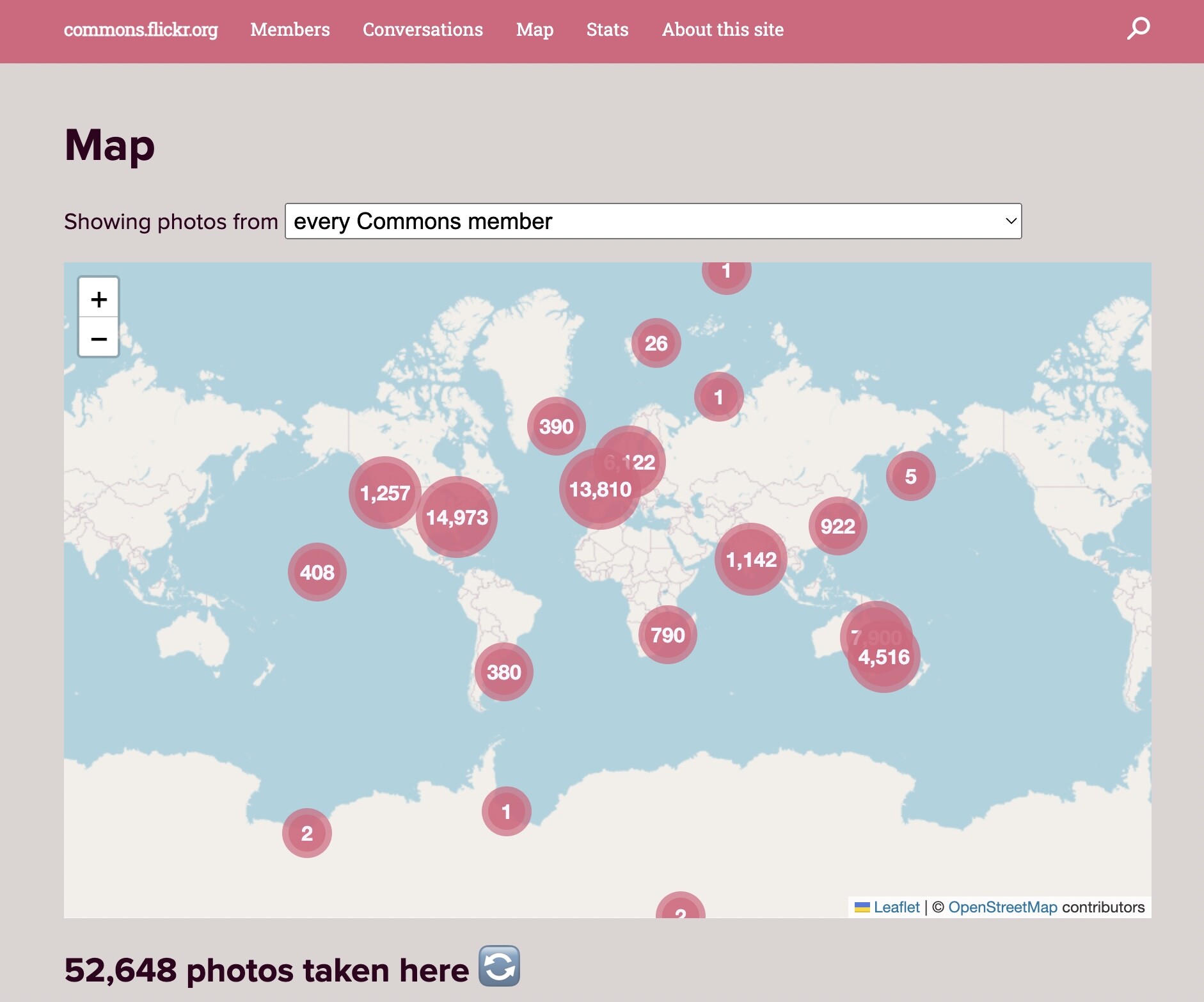
There’s great stuff happening out of the new energy happening at the Flickr Commons, including this gem where some 52,000+ public domain photos with some kind of geolocation reference data can now be explored via a map.
https://commons.flickr.org/map/
Of course the first thing one does is look for something near where they live, and heck indeed, I found a 1919 photo of downtown Moose Jaw, Saskatchewan from a Prince of Wales cross Canada Tour. The buildings I see there are still around.
The site does great to draw you in as well from random mapped photos on the front page. Given our attention now on Brisbane as host site for the 2024 OEGlobal Conference, I spotted on there from conference co-host the State Library of Queensland

Boy with sugarcane at the Royal National Show Brisbane, 1948 flickr photo by State Library of Queensland, Australia shared with no copyright restriction (Flickr Commons)
The map even lets you explore all geolocated photos shared into the Flickr Commons by the State Library of Queensland - explore and you will find their photos span from many places beyond Australia.
Or zoom in to find some 2000 or so public domain flickr commons photos around Brisbane and even closer some in the vicinity of the conference venue. Maybe people who go to the conference can match locations to these photos.
Maps and old photos and the public domain, oh these are things I love to explore. What can you find? Where can you travel and explore via the flickr commons map? Share below.