The Global River Runner is a vizualization simulating the path a raindrop would take, assuming it runs off into a stream and from then on to a terminating location, likely an inland water body or the ocean. A running list of interesting flow paths can be found here.
The Global River Runner is an open source Work In Progress, based on open data and open source software components, some of which themselves are in early or alpha development stages (all described in detail below). The vast majority of river paths calculated are based on topographic data collected and processed automatically, and may not reflect true river paths that may be affected by engineered features such as dams, canals, and conduits.
The front end visualization was developed by Sam Learner. The back end is developed by Dave Blodgett, Kyle Onda and Ben Webb as a demonstrator of several key aspects of the Internet of Water project, including leveraging open data, open source software, and open standards to create innovative water information products and applications.
This is one among many items I will regularly tag in Pinboard as oegconnect, and automatically post tagged as #OEGConnect to Mastodon. Do you know of something else we should share like this? Just reply below and we will check it out.
A year or two ago I saw the original River Runner tool where you could click anywhere in the USA that represents a rain drop, and it determines the most likely route for that drop to run its full course through tributaries.
It’s an amazing thing to try, explore, and share (and its built all on open data and opensource software).
But the drops can only fall inside the United States!
Today a K-12 teacher colleague Brian posted in Mastodon about his students working on mapping watersheds and tributaries:
I remembered River Runner and shared with him the link (not surprised to to hear he had known of it before).
But when checking the link I noticed in the bottom corner that a global version was available, hence the link above.
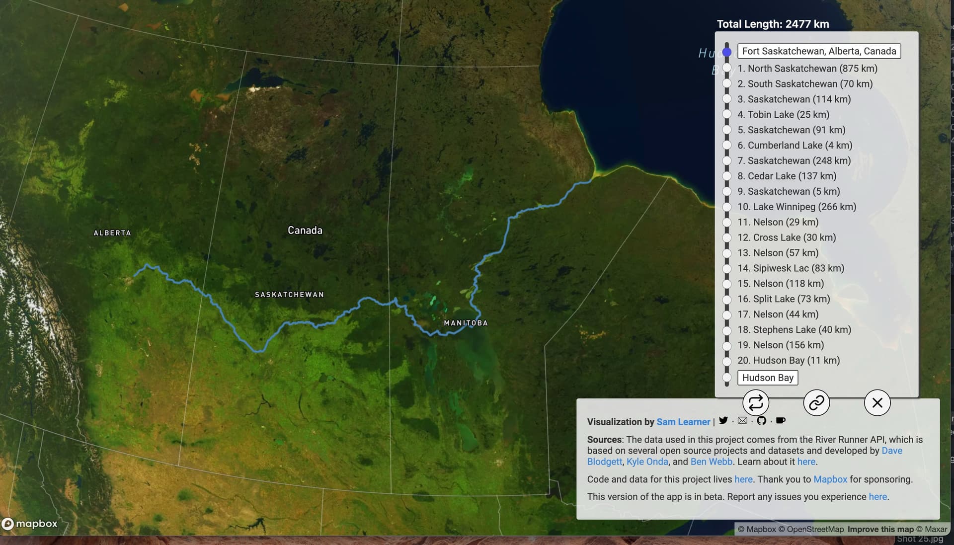
Here to whole world is available to see the same experience. Since remembering being at the OEGlobal 2023 Conference in Edmonton, where the venue was right on the banks of the North Saskatchewan River, I dropped my rain drop just norther east of the city. It produced a path of following the North Saskatchewan River across Saskatchewan (where I live) and on into Manitoba and ultimate ending its journet in the Hudson Bay:
Note how it provides a total length of the journey (which could lead to experiments testing flow lengths from different points, and each tributary along the way, with the length of each segment.
Every result has a link that can be shared so someone else can explore the same journey-- here, follow my drop!
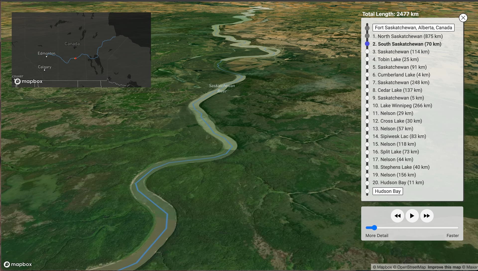
The fun part is setting the trip in motion, the map shifts to an oblique view and you follow the route my drop of water takes, here it is in central Saskatchewan:
This is absolutely amazing and must have great potential as a hydrology, geomorphology, geography teaching tool, right?
It’s worth reading the project overview, to see the documentation of the open data source (CC licensed), the various open source code libraries, and then it runs as a service with an open API
The back end API is served by pygeoapi, an open-source python server for publishing geospatial data and web-based geoprocessing jobs. The API interacts with the data in a PostGIS/PostgreSQL database. These are all incredibly useful, free and open source technologies for creating spatial data infrastructure that support innovative web applications.
Our API for tracing downstream river flowpaths is documented in the OpenAPI standard here. The code underlying the API is available here.
The basic use of the API is to provide the latitude and longitude of a start point, and you will be returned a geojson file of line segments representing the flowpath downstream on the start point.
And now you can use this nifty tool for any point ion the globe. Give the Global River Runner a stry, and share a link to a path you explored?